|
The use of remote sensors as a tool for squid positioning
The 1st Workshop on the use of satellite images in the Argentine squid fishery was held
 ARGENTINA
Friday, September 25, 2020, 02:00 (GMT + 9)
Its objectives were to know the potential of Remote Sensing as a complementary tool in the development of Argentine squid fishing and to identify the main satellite products that are necessary and useful for the jigging fleet.
.png) Aimed at captains, shipowners and entities related to the fishery, last Thursday, September 17, the "I Workshop on the use of satellite images in the Argentine squid ( Illex argentinus ) fishery " was held, organized by the Institute's Remote Sensing program National Fisheries Research and Development (INIDEP), in collaboration with the Cephalopod Fisheries program of the Institute and the National Commission for Space Activities (CONAE). Aimed at captains, shipowners and entities related to the fishery, last Thursday, September 17, the "I Workshop on the use of satellite images in the Argentine squid ( Illex argentinus ) fishery " was held, organized by the Institute's Remote Sensing program National Fisheries Research and Development (INIDEP), in collaboration with the Cephalopod Fisheries program of the Institute and the National Commission for Space Activities (CONAE).
This meeting constituted the first stage of the project “Training on the use of satellite images in the Argentine squid fishery Illex argentinus ”, approved according to Act No. 16/2020 of the Federal Fisheries Council (CFP), .jpg) within the framework of the Program to support the Training and Qualification of the fishing staff of (2020 Call).
The objective of the workshop was to know the potential of Remote Sensing as a complementary tool in the development of Argentine squid fishing and to identify the main satellite products that are of need and utility for the jigging fleet.
53 representatives from different sectors participated: Ministry of Foreign Relations, International Trade and Worship; Undersecretariat of Fisheries and Aquaculture of the Nation; Undersecretariat of Fisheries of Tierra del Fuego, Antarctica and the South Atlantic Islands; Secretary of State for Fisheries and Aquaculture of Santa Cruz; Ministry of Agrarian Development of the province of Buenos Aires; personnel from the Argentine Naval Prefecture (PNA) and the Argentine Navy (AA); technicians and officials of the Federal Fisheries Council (CFP); shipowners; Business.
 fis_com(1).jpg) The Ing. Ezequiel Cozzolino, head of the Remote Sensing Program, spoke first about the potential of using satellite images and their application in fisheries research.
For his part, from the Cephalopod Fisheries program, Lic. Nicolás Prandoni made a presentation on the importance, characterization and distribution of the Argentine squid fishery.
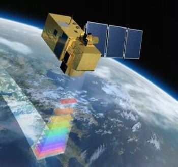
Finally, from CONAE, Dr. Sandra Torrusio and Ing. Patricio Fluxa , spoke about the National Space Plan and the SABIA-Mar mission.
Image: courtesy INIDEP
Once the presentations were completed, the space for consultation and debate was opened about the type of information currently used as support during the development of the tide. In this sense, and with a view to developing satellite products according to the needs of the sector, work continues on a survey to translate them into a second workshop that will take place between the months of November and December.
|


.jpg)
 Print
Print